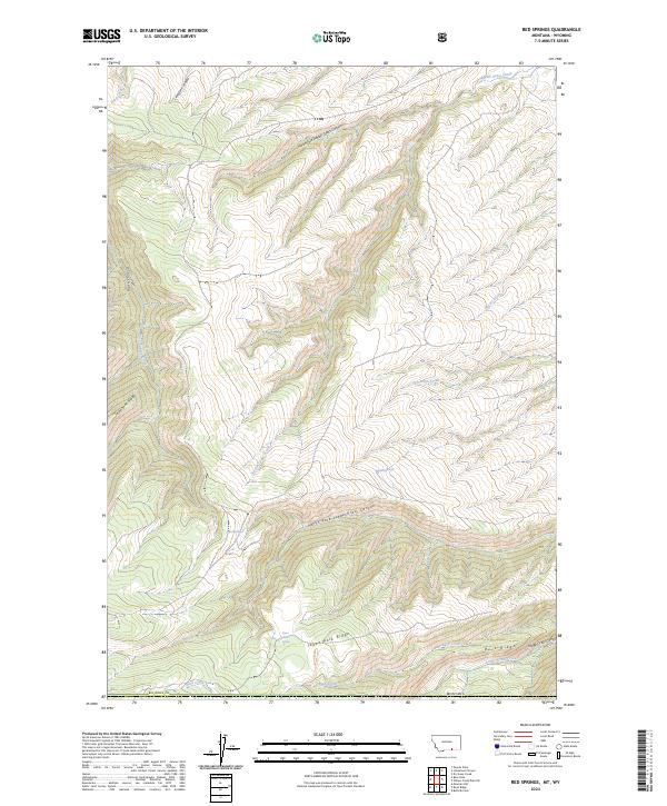
2024 Map of Red Springs
USGS Topo · Published 2024About this map
Big Horn County terrain dominates this 2024 landscape, where the high-elevation drainage systems of the Bighorn Mountains carve deep canyons through Montana and into Wyoming. The namesake Red Springs area sits amidst a complex network of ridges, including Telephone Ridge and Tepee Pole Ridge, which separate the various forks of Rotten Grass Creek and Lodge Grass Creek. These watercourses create a distinct topographic pattern of steep-walled canyons such as Black Canyon and Lodge Grass Canyon. The map is particularly useful for tracking localized water sources like Tepee Spring and Paint Springs, which have long served as vital points in this arid, high-country environment. The presence of varied landmarks like Buck Ridge and Limestone Canyon highlights the geological diversity of the Crow Indian Reservation borderlands during the early 21st century.
Find a feature on this map
25 named features on this map. Tap any name to fly to it.
Don’t see what you’re looking for? This feature index may not catch every label — zoom into the map to look around manually.
Map Details
Editions of this 2024 Red Springs Map
This is the sole edition of this map. No revisions or reprints were ever made.
Other maps of this area

1894 · St. Xavier
USGS Topo · 1:125,000

1898 · Bald Mountain
USGS Topo · 1:125,000

1901 · St. Xavier
USGS Topo · 1:125,000

1901 · Bald Mountain
USGS Topo · 1:125,000

1954 · Hardin
USGS Topo · 1:250,000

1955 · Sheridan
USGS Topo · 1:250,000

1957 · Hardin
USGS Topo · 1:250,000

1958 · Hardin
USGS Topo · 1:250,000

1958 · Sheridan
USGS Topo · 1:250,000

1960 · Boyd Ridge
USGS Topo · 1:24,000