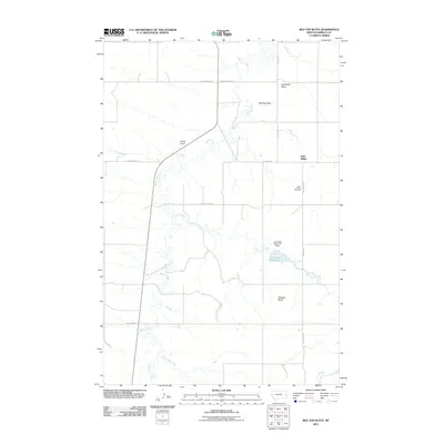
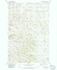
2011 Map of Red Top Butte
USGS Topo · Published 2011About this map
Saint Phillip remains the primary focal point of this Eastern Montana landscape, established in an area where the open prairie meets the distinctive topographic rises of the plains. The region is characterized by prominent landmarks including Red Top Butte and Jackrabbit Butte, which provided essential navigational points for early travelers. The local infrastructure is deeply tied to the natural watercourses, with Beaver Creek and Lamesteer Creek winding through the terrain. The creation of Lamesteer Reservoir and the Lamesteer Reservoir Dam signifies the importance of water management in this arid environment. Significant local history and genealogy can be traced through the Saint Philips Cemetery, while the network of primitive routes like Custer Trl and Last Chance Trl reflect the historical movement of settlers across Wibaux County near the state line.
Find a feature on this map
21 named features on this map. Tap any name to fly to it.
Don’t see what you’re looking for? This feature index may not catch every label — zoom into the map to look around manually.
Map Details
Editions of this 2011 Red Top Butte Map
This is the sole edition of this map. No revisions or reprints were ever made.
Other maps of this area

1953 · Miles City
USGS Topo · 1:250,000

1957 · Miles City
USGS Topo · 1:250,000

1958 · Miles City
USGS Topo · 1:250,000

1981 · Cap Rock
USGS Topo · 1:24,000

1981 · Carlyle
USGS Topo · 1:24,000
1981 · Carlyle NW
USGS Topo · 1:24,000

1981 · Wibaux
USGS Topo · 1:100,000
1982 · Hodges SE
USGS Topo · 1:24,000
1982 · Red Top Butte
USGS Topo · 1:24,000
1982 · Freeman Creek
USGS Topo · 1:24,000