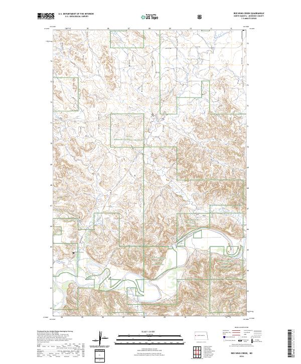
2024 Map of Red Wing Creek
USGS Topo · Published 2024About this map
The Little Missouri National Grassland dominates this McKenzie County landscape, where the broken terrain is defined by a dense network of drainage systems. At the heart of this region, Red Wing Creek and its tributaries, including Bummer Creek and Spring Creek, carve through the badlands, creating a complex topography that has historically influenced travel and land use. The presence of Stevenson Cem near the junction of Red Wing Rd and Cedar Creek provides a localized point of interest for genealogists tracing early residency in this sparsely populated area.
Find a feature on this map
23 named features on this map. Tap any name to fly to it.
Don’t see what you’re looking for? This feature index may not catch every label — zoom into the map to look around manually.
Map Details
Editions of this 2024 Red Wing Creek Map
This is the sole edition of this map. No revisions or reprints were ever made.
Other maps of this area

1953 · Watford City
USGS Topo · 1:250,000

1957 · Watford City
USGS Topo · 1:250,000

1958 · Sperati Point
USGS Topo · 1:24,000

1958 · Stocke Butte
USGS Topo · 1:24,000

1967 · Watford City
USGS Topo · 1:250,000

1972 · Bear Butte
USGS Topo · 1:24,000

1972 · Moline School
USGS Topo · 1:24,000
1972 · Burning Mine Butte
USGS Topo · 1:24,000

1974 · Wolf Coulee
USGS Topo · 1:24,000
1974 · Ice Box Canyon
USGS Topo · 1:24,000