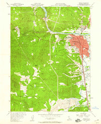
1957 Map of Redding
USGS Topo · Published 1958About this map
The Sacramento River bisects the landscape of northern California in the mid-1950s, anchoring the growing city of Redding and the industrial activity of the surrounding Shasta County terrain. The Southern Pacific railroad corridor runs parallel to the river, supporting the regional economy alongside significant infrastructure like the Benton Airport and the Redding Sky Ranch Airport. To the west, the historical character of the region is preserved at the Shasta State Historical Monument, while active mining legacies are visible at the Yankee John Mine and the extensive Dredge Tailings along Clear Creek. Residential and institutional expansion is evident through the placement of Shasta College, Mercy Hospital, and the Cascade Sanatorium. This survey captures a transitional moment as the area's gold-mining past, marked by the Clear Cr Gold Discovery Historical Marker, meets the post-war urbanization of the city center.
Find a feature on this map
53 named features on this map. Tap any name to fly to it.
Don’t see what you’re looking for? This feature index may not catch every label — zoom into the map to look around manually.
Map Details
Editions of this 1957 Redding Map
4 editions found
Other maps of this area

1890 · Red Bluff
USGS Topo · 1:250,000

1894 · Red Bluff
USGS Topo · 1:250,000

1901 · Redding
USGS Topo · 1:125,000

1913 · Weaverville
USGS Topo · 1:125,000

1932 · Olinda
USGS Topo · 1:31,680

1935 · Olinda
USGS Topo · 1:31,680

1944 · Redding
USGS Topo · 1:62,500

1944 · French Gulch
USGS Topo · 1:62,500

1946 · Redding
USGS Topo · 1:62,500

1947 · Anderson
USGS Topo · 1:62,500