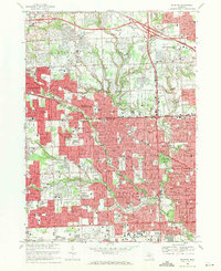
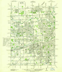
1968 Map of Redford
USGS Topo · Published 1971About this map
Redford and its surrounding suburbs during the late 1960s reflect a landscape of intense post-war expansion where the Oakland Co Wayne Co line serves as a central axis. This period captures the dense integration of residential neighborhoods with institutional anchors, including the sprawling grounds of Holy Sepulchre Cemetery and the Oakland College (Orchard Ridge Campus). The survey records a high concentration of parochial and public education facilities, such as Clarenceville High Sch and St Agatha Sch, highlighting the domestic growth that filled the space between established centers like Farmington and Livonia. Heavy infrastructure like Interstate 96 and the Chesapeake and Ohio railroad corridor cut through the grid, while the Rouge River and Bell Branch provide the primary natural breaks in the suburban fabric, winding through Eliza Howell Park and River Rouge Park.
Find a feature on this map
101 named features on this map. Tap any name to fly to it.
Don’t see what you’re looking for? This feature index may not catch every label — zoom into the map to look around manually.
Map Details
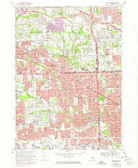
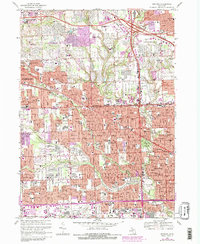
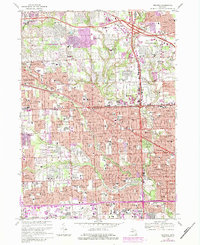
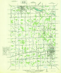
Editions of this 1968 Redford Map
4 editions found
Other maps of this area

1905 · Wayne
USGS Topo · 1:62,500

1905 · Detroit
USGS Topo · 1:62,500

1907 · Pontiac
USGS Topo · 1:62,500

1908 · Rochester
USGS Topo · 1:62,500

1912 · Wayne
USGS Topo · 1:62,500

1918 · Detroit
USGS Topo · 1:62,500

1924 · Detroit
USGS Topo · 1:62,500

1934 · Detroit
USGS Topo · 1:62,500
1936 · Inkster
USGS Topo · 1:31,680
1936 · Wayne
USGS Topo · 1:31,680