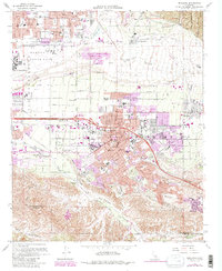
1967 Map of Redlands
USGS Topo · Published 1988About this map
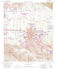
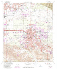
The city of Redlands serves as the focal point of this Inland Empire study, situated between the expansive Santa Ana Wash and the southern slopes of San Timoteo Canyon. The map details the mid-century suburban expansion of San Bernardino County, particularly the growth radiating from the city center toward Mentone and Crafton. A complex network of irrigation and water management is visible, including The Zanja and several reservoirs, reflecting the region's agricultural foundations even as residential developments like Crown Jewel and Bryn Mawr began to fill the landscape.
Find a feature on this map
83 named features on this map. Tap any name to fly to it.
Don’t see what you’re looking for? This feature index may not catch every label — zoom into the map to look around manually.
Map Details
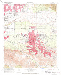
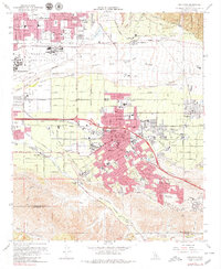
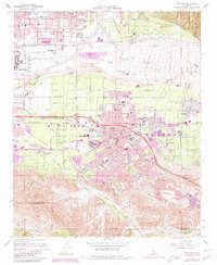
Editions of this 1967 Redlands Map
6 editions found
Other maps of this area

1896 · San Bernardino
USGS Topo · 1:62,500

1898 · San Bernardino
USGS Topo · 1:62,500

1899 · Redlands
USGS Topo · 1:62,500

1901 · Southern California Sheet No. 1
USGS Topo · 1:250,000

1901 · San Bernardino
USGS Topo · 1:62,500

1901 · Redlands
USGS Topo · 1:62,500

1901 · Elsinore
USGS Topo · 1:125,000

1901 · Riverside
USGS Topo · 1:62,500

1904 · Southern California Sheet No. 1
USGS Topo · 1:250,000
1936 · Arrowhead
USGS Topo · 1:31,680