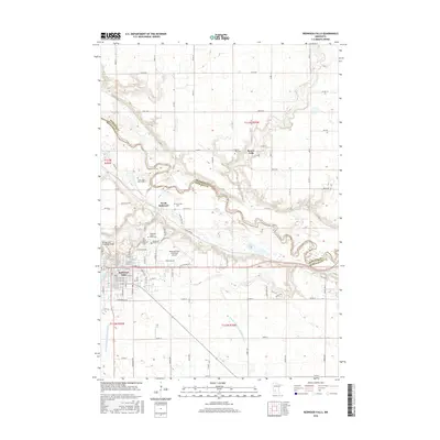
2016 Map of Redwood Falls
USGS Topo · Published 2016About this map
Redwood Falls sits at the confluence of the Redwood River and the Minnesota River, serving as a central hub for this portion of southern Minnesota. The landscape is defined by the deep carving of the river valleys through the surrounding prairie, with the Ramsey Park Swayback Bridge marking a point of local interest near the town center. The area is notable for its numerous burial sites and small settlements, including Beaver Falls and North Redwood, which reflect the long-standing community footprint along the river bluffs.
Find a feature on this map
98 named features on this map. Tap any name to fly to it.
Don’t see what you’re looking for? This feature index may not catch every label — zoom into the map to look around manually.
Map Details
Editions of this 2016 Redwood Falls Map
This is the sole edition of this map. No revisions or reprints were ever made.
Other maps of this area

1952 · Morton
USGS Topo · 1:62,500

1952 · Redwood Falls
USGS Topo · 1:62,500

1953 · Morgan
USGS Topo · 1:62,500

1953 · New Ulm
USGS Topo · 1:250,000

1957 · New Ulm
USGS Topo · 1:250,000

1958 · New Ulm
USGS Topo · 1:250,000

1967 · New Ulm
USGS Topo · 1:250,000

1967 · Clements
USGS Topo · 1:24,000

1967 · Rowena
USGS Topo · 1:24,000
1982 · Vicksburg
USGS Topo · 1:24,000