
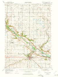
1952 Map of Redwood Falls
USGS Topo · Published 1954About this map
Redwood Falls serves as the hub of this 1952 survey, situated at the confluence where the Redwood River joins the Minnesota River. The landscape is defined by the deeply incised river valleys and a dense network of early rural infrastructure, including numerous schoolhouses like School No 8 and School No 71. Of particular historical interest is the Lower Sioux Indian Community in the southeast and the Alexander Ramsey State Park adjacent to the city center. The map details the transition of the region's transport economy, showing the Chicago and North Western rail lines alongside established river settlements like Beaver Falls and North Redwood. Genealogists will find value in the specific placement of country churches and cemeteries, such as Bethany Ch and Calgary Cem, which anchored the surrounding townships of Emmet and Flora during the mid-twentieth century.
Find a feature on this map
64 named features on this map. Tap any name to fly to it.
Don’t see what you’re looking for? This feature index may not catch every label — zoom into the map to look around manually.
Map Details
Editions of this 1952 Redwood Falls Map
2 editions found
Other maps of this area

1952 · Morton
USGS Topo · 1:62,500

1953 · Morgan
USGS Topo · 1:62,500

1953 · New Ulm
USGS Topo · 1:250,000

1957 · New Ulm
USGS Topo · 1:250,000

1957 · Olivia
USGS Topo · 1:62,500

1958 · New Ulm
USGS Topo · 1:250,000

1965 · Danube
USGS Topo · 1:24,000

1965 · Belview
USGS Topo · 1:24,000

1965 · Iverson Lake
USGS Topo · 1:24,000

1965 · Sacred Heart
USGS Topo · 1:24,000