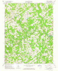
1963 Map of Redwood
USGS Topo · Published 1965About this map
The Blackwater River and Maggodee Creek carve through this rural Franklin County landscape, meeting at the western edge of the rising Smith Mountain Lake. In the early 1960s, the area remained deeply agricultural, anchored by small settlements like Redwood and Burnt Chimney. Local life is recorded through a dense network of family landmarks, including the Jefferson Cem, Dillon Cem, and Poindexter Cem, alongside community hubs like the Redwood Sch and Chestnut Grove Ch.
Find a feature on this map
59 named features on this map. Tap any name to fly to it.
Don’t see what you’re looking for? This feature index may not catch every label — zoom into the map to look around manually.
Map Details
Editions of this 1963 Redwood Map
4 editions found
Other maps of this area

1890 · Roanoke
USGS Topo · 1:125,000

1891 · Roanoke
USGS Topo · 1:125,000

1922 · Callands
USGS Topo · 1:48,000

1924 · Callands
USGS Topo · 1:62,500

1925 · Rocky Mount
USGS Topo · 1:48,000

1927 · Rocky Mount
USGS Topo · 1:62,500

1944 · Rocky Mount
USGS Topo · 1:62,500

1944 · Callands
USGS Topo · 1:62,500

1947 · Roanoke
USGS Topo · 1:250,000

1951 · Boones Mill
USGS Topo · 1:62,500