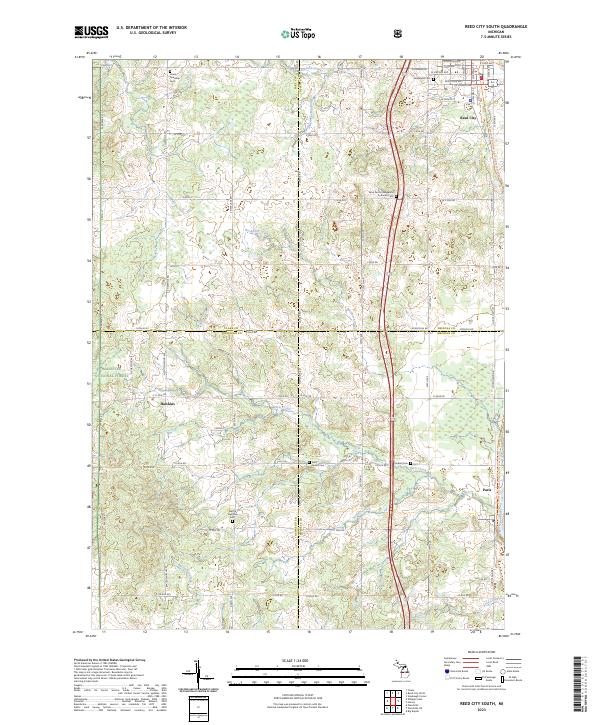
2023 Map of Reed City South
USGS Topo · Published 2023About this map
Reed City serves as the northern anchor for this landscape where agriculture and timberlands meet at the intersection of four Michigan counties. The map illustrates a rural network of section-line roads and family-owned lands across Lake Co, Osceola Co, Newaygo Co, and Mecosta Co. A notable concentration of community burial grounds, including the Woodland Cem, Saint Anne's Cem, and Parkhill Cem, provides significant data points for genealogists tracing local families across township lines. The western portion of the quadrangle is defined by the Manistee National Forest, where the terrain transitions into protected woodlands. Small settlements like Paris and Hawkins remain connected by historical routes, while the Muskegon River flows through the southeastern corner, historically serving as a vital artery for the region's early logging industry.
Find a feature on this map
81 named features on this map. Tap any name to fly to it.
Don’t see what you’re looking for? This feature index may not catch every label — zoom into the map to look around manually.
Map Details
Editions of this 2023 Reed City South Map
This is the sole edition of this map. No revisions or reprints were ever made.
Other maps of this area

1931 · Chase NE
USGS Topo · 1:31,680

1932 · Chase NW
USGS Topo · 1:31,680

1954 · Midland
USGS Topo · 1:250,000

1958 · Midland
USGS Topo · 1:250,000

1958 · Woodville
USGS Topo · 1:62,500

1958 · Big Rapids
USGS Topo · 1:62,500

1959 · Midland
USGS Topo · 1:250,000

1959 · Evart
USGS Topo · 1:62,500

1959 · Reed City
USGS Topo · 1:62,500

1966 · Midland
USGS Topo · 1:250,000