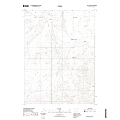
2017 Map of Reed Reservoir
USGS Topo · Published 2017About this map
Cottonwood Bench and the high desert terrain of southern Uinta County define this landscape, where a sophisticated network of small-scale water management features supports life in the arid basin. The map detail highlights numerous high-altitude basins and drainages, including Crooked Canyon and Dog Spring Wash, which channel seasonal runoff into essential catchments like Whisky Reservoir and Clematis Reservoir. The presence of these named reservoirs, alongside Sage Mountain Reservoir and Balsam Root Reservoir, reflects the area's historical reliance on livestock ranching and the careful control of local watersheds. Rugged transportation routes such as Cedar Mountain Rd and Reed Rd provide the primary access through this sparsely populated corner of Wyoming, while Sage Creek Mtn anchors the southern portion of the survey near the headwaters of Sage Cr.
Find a feature on this map
24 named features on this map. Tap any name to fly to it.
Don’t see what you’re looking for? This feature index may not catch every label — zoom into the map to look around manually.
Map Details
Editions of this 2017 Reed Reservoir Map
This is the sole edition of this map. No revisions or reprints were ever made.
Other maps of this area

1954 · Ogden
USGS Topo · 1:250,000

1958 · Ogden
USGS Topo · 1:250,000

1960 · Ogden
USGS Topo · 1:250,000

1964 · Butcher Knife Draw
USGS Topo · 1:24,000

1964 · Soap Holes Reservoir
USGS Topo · 1:24,000

1964 · Reed Reservoir
USGS Topo · 1:24,000

1964 · Mountain View
USGS Topo · 1:24,000
1964 · Lonetree
USGS Topo · 1:24,000
1964 · Table Mountain
USGS Topo · 1:24,000
1964 · Burntfork
USGS Topo · 1:24,000