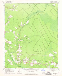
1969 Map of Reelsboro
USGS Topo · Published 1970About this map
The settlement of Reelsboro and the nearby hamlet of Olympia define the southern corridor of this eastern North Carolina landscape, where the Norfolk Southern railroad tracks run parallel to local thoroughfares. The terrain is characterized by a dense network of lowland drainages and wetlands, most notably the meandering Upper Broad Creek and the curiously named Possum Savannah Bridge Swamp. These water systems carve through a region of scattered agriculture and timberland, divided by historical county lines between Pamlico, Craven, and Beaufort.
Find a feature on this map
40 named features on this map. Tap any name to fly to it.
Don’t see what you’re looking for? This feature index may not catch every label — zoom into the map to look around manually.
Map Details
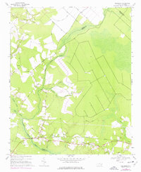
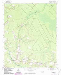
Editions of this 1969 Reelsboro Map
3 editions found
Other maps of this area

1901 · New Bern
USGS Topo · 1:62,500

1902 · Vanceboro
USGS Topo · 1:62,500

1903 · New Bern
USGS Topo · 1:62,500

1904 · Vanceboro
USGS Topo · 1:62,500

1905 · Vanceboro
USGS Topo · 1:62,500

1950 · New Bern
USGS Topo · 1:24,000

1950 · Aurora
USGS Topo · 1:24,000

1950 · Edward
USGS Topo · 1:24,000

1950 · Upper Broad Creek
USGS Topo · 1:24,000

1950 · Arapahoe
USGS Topo · 1:24,000