
1952 Map of Reelsville
USGS Topo · Published 1954About this map
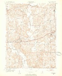
The Eel River meanders through this portion of Putnam County, carving a valley that separates the northern agricultural uplands from the varied industrial and institutional landscapes to the south and east. In the early 1950s, the National Road and the Pennsylvania railroad served as the primary east-west arteries, passing through the village of Reelsville and the community at Pleasant Gardens. A significant portion of the eastern territory is occupied by the State Farm, an area characterized by institutional infrastructure including a sewage disposal plant and a Radio Tower.
Find a feature on this map
42 named features on this map. Tap any name to fly to it.
Don’t see what you’re looking for? This feature index may not catch every label — zoom into the map to look around manually.
Map Details
Editions of this 1952 Reelsville Map
2 editions found
Other maps of this area

1908 · Clay City
USGS Topo · 1:48,000

1910 · Clay City
USGS Topo · 1:62,500

1950 · Brazil East
USGS Topo · 1:24,000

1951 · Clinton Falls
USGS Topo · 1:24,000

1951 · Mansfield
USGS Topo · 1:24,000

1953 · Indianapolis
USGS Topo · 1:250,000

1956 · Indianapolis
USGS Topo · 1:250,000

1956 · Cloverdale
USGS Topo · 1:24,000

1956 · Cataract
USGS Topo · 1:24,000

1957 · Indianapolis
USGS Topo · 1:250,000