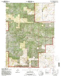
1992 Map of Reese Mountain
USGS Topo · Published 1996About this map
The Medicine Bow National Forest dominates this section of the Laramie Mountains, where the high-altitude landscape transitions between Albany and Platte counties. Rugged peaks like Reese Mountain, Bills Mountain, and North Collins Peak define the local skyline, while the drainage network of the Laramie River and its tributaries, such as Duck Creek and Ringrose Creek, carve deep reliefs into the terrain.
Find a feature on this map
36 named features on this map. Tap any name to fly to it.
Don’t see what you’re looking for? This feature index may not catch every label — zoom into the map to look around manually.
Map Details
Editions of this 1992 Reese Mountain Map
2 editions found
Other maps of this area

1953 · Squaw Rock
USGS Topo · 1:24,000

1953 · Hightower SW
USGS Topo · 1:24,000

1953 · Johnson Mountain
USGS Topo · 1:24,000

1954 · Torrington
USGS Topo · 1:250,000

1954 · Cheyenne
USGS Topo · 1:250,000

1955 · Moonshine Peak
USGS Topo · 1:24,000

1955 · Bull Camp Peak
USGS Topo · 1:24,000

1958 · Cheyenne
USGS Topo · 1:250,000

1958 · Torrington
USGS Topo · 1:250,000

1968 · Davidson Flats
USGS Topo · 1:24,000