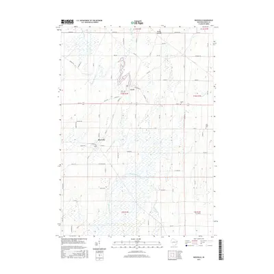
2015 Map of Reeseville
USGS Topo · Published 2015About this map
Reeseville and Lowell anchor this agricultural landscape in Dodge County, where the Beaver Dam River and its tributaries carve a path through the glacial terrain. The geography is defined by a dense network of local roads and water bodies, including the Lowell Millpond and several significant creeks such as Pratt Cr and Cold Spring Cr. The layout of the villages reflects their growth as rural hubs, with North Lowell marking the northern extent of these interconnected settlements.
Find a feature on this map
67 named features on this map. Tap any name to fly to it.
Don’t see what you’re looking for? This feature index may not catch every label — zoom into the map to look around manually.
Map Details
Editions of this 2015 Reeseville Map
This is the sole edition of this map. No revisions or reprints were ever made.
Other maps of this area

1891 · Waterloo
USGS Topo · 1:62,500

1892 · Watertown
USGS Topo · 1:62,500

1894 · Waterloo
USGS Topo · 1:62,500

1894 · Watertown
USGS Topo · 1:62,500

1910 · Waterloo
USGS Topo · 1:62,500

1955 · Beaver Dam
USGS Topo · 1:62,500

1955 · Horicon
USGS Topo · 1:62,500

1957 · Madison
USGS Topo · 1:250,000
1959 · Richwood
USGS Topo · 1:24,000
1959 · Waterloo
USGS Topo · 1:24,000