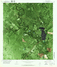
1979 Map of Refugio
USGS Topo · Published 1979About this map
The Mission River winds in deep oxbows through the coastal plains of South Texas, defining the physical and economic landscape of the late 1970s. This orthophotomap provides a clear view of the town of Refugio, showing the structured grid of the settlement as it interfaces with the heavy industry and agriculture of the region. The map highlights the town's social and logistical infrastructure, from the Mt Calvary Cem to the County Fairground and County Country Club.
Find a feature on this map
17 named features on this map. Tap any name to fly to it.
Don’t see what you’re looking for? This feature index may not catch every label — zoom into the map to look around manually.
Map Details
Editions of this 1979 Refugio Map
This is the sole edition of this map. No revisions or reprints were ever made.
Other maps of this area

1953 · Beeville
USGS Topo · 1:250,000

1954 · Rockport
USGS Topo · 1:62,500

1954 · Woodsboro
USGS Topo · 1:62,500

1954 · Vidaurri
USGS Topo · 1:62,500

1954 · Refugio
USGS Topo · 1:62,500

1956 · Beeville
USGS Topo · 1:250,000

1960 · Beeville
USGS Topo · 1:250,000

1978 · Woodsboro
USGS Topo · 1:24,000

1978 · Ryanville
USGS Topo · 1:24,000

1978 · Vidaurri
USGS Topo · 1:24,000