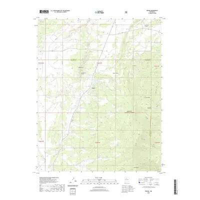
2020 Map of Regina
USGS Topo · Published 2020About this map
Regina serves as the central settlement on this 2020 map, situated near the boundary where the high San Pedro Mountains meet the transition to Badland Hills. The landscape is defined by its water resources and complex topography, featuring the Continental Divide winding through the western sections. Local life is centered around rural infrastructure such as the Regina Cem and the Regina Store Spring, while the eastern portion of the map is dominated by the Santa Fe National Forest. Numerous springs and lakes, including Hatch Lake, Williams Lake, and La Jara Ranch Spring, indicate the vital importance of water in this high-elevation environment. Historically, the area is navigated by a network of local routes like Old HWY 95 and Co RD 392, reflecting the settlement patterns at the Rio Arriba and Sandoval county line.
Find a feature on this map
41 named features on this map. Tap any name to fly to it.
Don’t see what you’re looking for? This feature index may not catch every label — zoom into the map to look around manually.
Map Details
Editions of this 2020 Regina Map
This is the sole edition of this map. No revisions or reprints were ever made.
Other maps of this area

1889 · Largo
USGS Topo · 1:250,000

1895 · Largo
USGS Topo · 1:250,000

1909 · Gallina
USGS Topo · 1:125,000

1940 · Cuba
USGS Topo · 1:62,500

1943 · Cuba
USGS Topo · 1:62,500

1954 · Aztec
USGS Topo · 1:250,000

1955 · Llaves
USGS Topo · 1:62,500

1958 · Aztec
USGS Topo · 1:250,000

1962 · Aztec
USGS Topo · 1:250,000

1963 · Lindrith
USGS Topo · 1:24,000