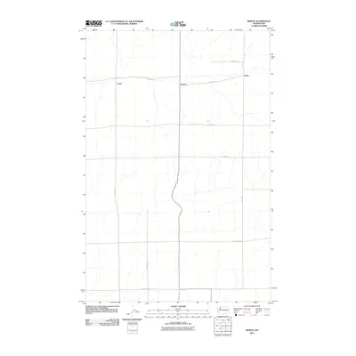
2011 Map of Reiman
USGS Topo · Published 2011About this map
Agricultural operations and wide-set rural settlements define the landscape of Adams County as documented in the early 21st century. The small communities of Reiman and Lauer serve as focal points for a vast network of section-line roads, many of which bear the names of local families. The grid is anchored by routes such as N Lauer Rd and N Jantz Rd, which facilitate the movement of crops across this high plateau region. This survey captures the spatial relationship between isolated farmsteads and the transport corridors that connect them, including E Tokio Rd and Griffith Rd E. The map's layout highlights the enduring importance of the homestead system in eastern Washington, where place names like Jantz indicate the deep roots of local lineage and early 20th-century land parcels.
Find a feature on this map
14 named features on this map. Tap any name to fly to it.
Don’t see what you’re looking for? This feature index may not catch every label — zoom into the map to look around manually.
Map Details
Editions of this 2011 Reiman Map
This is the sole edition of this map. No revisions or reprints were ever made.
Other maps of this area

1925 · Schrag
USGS Topo · 1:62,500

1953 · Ritzville
USGS Topo · 1:250,000

1959 · Ritzville
USGS Topo · 1:250,000

1965 · Ritzville
USGS Topo · 1:250,000

1967 · Reiman SW
USGS Topo · 1:24,000

1967 · Schoonover
USGS Topo · 1:24,000

1967 · Batum
USGS Topo · 1:24,000

1967 · Reiman
USGS Topo · 1:24,000
1967 · Schrag
USGS Topo · 1:24,000
1967 · Reiman SE
USGS Topo · 1:24,000