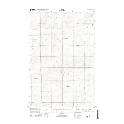
2013 Map of Reiman
USGS Topo · Published 2013About this map
Wa-21 bisects this agricultural landscape of Adams County, providing the primary north-south artery for a region defined by its rectilinear grid and scattered rural settlements. The tiny community of Reiman sits at a central junction, while the namesake locations of Lauer and Jantz anchor the western and eastern portions of the map. This terrain is marked by the distinct formation of Rocky Coulee in the northeast, which breaks the regularity of the surrounding fields. The grid of country roads, including N Lauer Rd, N Jantz Rd, and E Rosenoff Rd, reflects the systematic land divisions of the Public Land Survey System, specifically within townships t20n r32e and t20n r33e. These roads serve the family-named landmarks and agricultural holdings that have shaped the local identity of the Washington interior.
Find a feature on this map
26 named features on this map. Tap any name to fly to it.
Don’t see what you’re looking for? This feature index may not catch every label — zoom into the map to look around manually.
Map Details
Editions of this 2013 Reiman Map
This is the sole edition of this map. No revisions or reprints were ever made.
Other maps of this area

1925 · Schrag
USGS Topo · 1:62,500

1953 · Ritzville
USGS Topo · 1:250,000

1959 · Ritzville
USGS Topo · 1:250,000

1965 · Ritzville
USGS Topo · 1:250,000

1967 · Reiman SW
USGS Topo · 1:24,000

1967 · Schoonover
USGS Topo · 1:24,000

1967 · Batum
USGS Topo · 1:24,000

1967 · Reiman
USGS Topo · 1:24,000
1967 · Schrag
USGS Topo · 1:24,000
1967 · Reiman SE
USGS Topo · 1:24,000