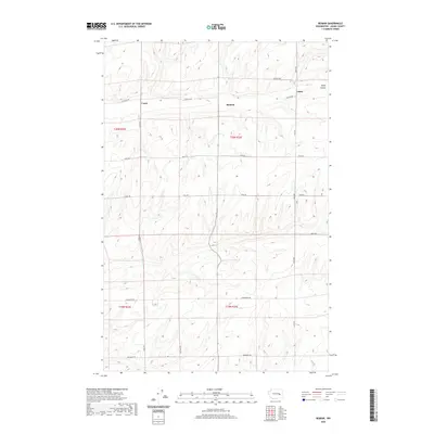
2020 Map of Reiman
USGS Topo · Published 2020About this map
Reiman and Lauer serve as central points in this agricultural landscape of Adams County, where the dry plateaus are carved by seasonal watercourses like Rocky Coulee. The map illustrates a highly organized section-line grid system, where long-established family names are preserved through the road network, including Griffith Rd, Schafer Rd, and Jantz Rd. This survey reflects the enduring spatial logic of the Inland Empire's wheat-growing regions, where small settlements like Jantz and Lauer sit along transit corridors such as Tokio Rd and Lauer Rd. The topography is dominated by the subtle, undulating drainage patterns characteristic of the region, providing a clear view of how early 21st-century land use follows the precise township and range boundaries of t20n r32e and t20n r33e.
Find a feature on this map
18 named features on this map. Tap any name to fly to it.
Don’t see what you’re looking for? This feature index may not catch every label — zoom into the map to look around manually.
Map Details
Editions of this 2020 Reiman Map
This is the sole edition of this map. No revisions or reprints were ever made.
Other maps of this area

1925 · Schrag
USGS Topo · 1:62,500

1953 · Ritzville
USGS Topo · 1:250,000

1959 · Ritzville
USGS Topo · 1:250,000

1965 · Ritzville
USGS Topo · 1:250,000

1967 · Reiman SW
USGS Topo · 1:24,000

1967 · Schoonover
USGS Topo · 1:24,000

1967 · Batum
USGS Topo · 1:24,000

1967 · Reiman
USGS Topo · 1:24,000
1967 · Schrag
USGS Topo · 1:24,000
1967 · Reiman SE
USGS Topo · 1:24,000