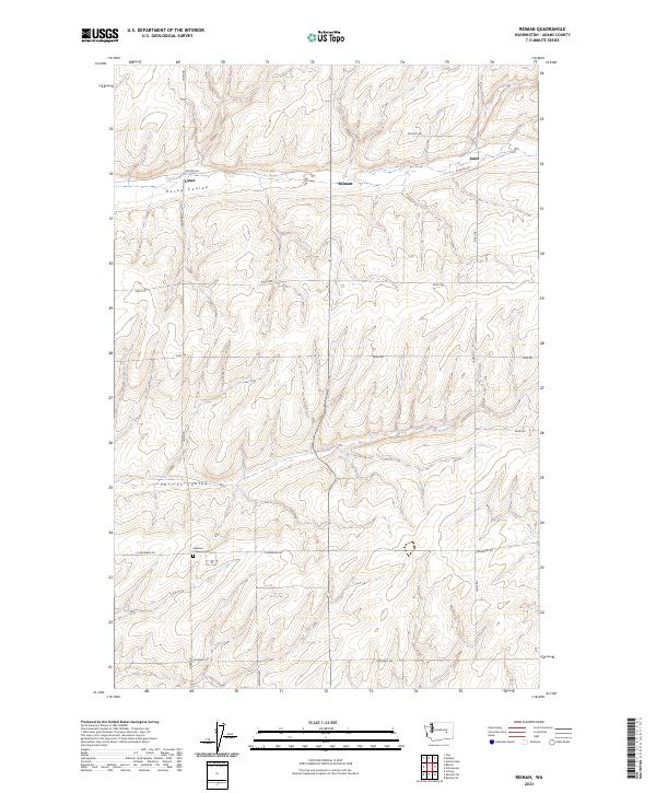
2023 Map of Reiman
USGS Topo · Published 2023About this map
The high plateaus of Adams County are defined by deep drainage systems like Rocky Coulee and Farrier Coulee, which cut through the agricultural landscape. This modern survey shows a rural environment where land use remains closely tied to the section lines of the Public Land Survey System, as seen in the grid of roads such as Lauer Rd and Tokio Rd. Small, localized settlements including Lauer, Reiman, and Jantz are situated along these transit corridors, reflecting the enduring pattern of wheat farming and dryland agriculture in Eastern Washington. Genealogists will find the Sackman Lutheran Cem near E Snowden Rd, a significant point of interest for tracing local family histories and early homesteading roots in the region.
Find a feature on this map
20 named features on this map. Tap any name to fly to it.
Don’t see what you’re looking for? This feature index may not catch every label — zoom into the map to look around manually.
Map Details
Editions of this 2023 Reiman Map
This is the sole edition of this map. No revisions or reprints were ever made.
Other maps of this area

1925 · Schrag
USGS Topo · 1:62,500

1953 · Ritzville
USGS Topo · 1:250,000

1959 · Ritzville
USGS Topo · 1:250,000

1965 · Ritzville
USGS Topo · 1:250,000

1967 · Reiman SW
USGS Topo · 1:24,000

1967 · Schoonover
USGS Topo · 1:24,000

1967 · Batum
USGS Topo · 1:24,000

1967 · Reiman
USGS Topo · 1:24,000
1967 · Schrag
USGS Topo · 1:24,000
1967 · Reiman SE
USGS Topo · 1:24,000