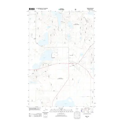
2013 Map of Remer
USGS Topo · Published 2013About this map
Remer serves as a small municipal anchor in the heart of the Chippewa National Forest, a landscape defined by an intricate network of glacial lakes and river systems. The town center, marked by a Po and Remer Municipal Airport, sits at the junction of State 200 NE and State 6 NE. Recreation is a primary land use, evidenced by the Cedar Point Resort and Campground on the shores of Big Sand Lake and the Little Sand Lake Campground further north. The hydrology of the region is complex, with the Willow River and its tributary Birch Br winding through wetlands to reach Mud Lake and Birch Lake. From the large expanse of Big Rice Lake in the south to the northern waters of Grave Lake, this survey documents a modern northern Minnesota community deeply integrated with its surrounding protected timberlands and waterways.
Find a feature on this map
35 named features on this map. Tap any name to fly to it.
Don’t see what you’re looking for? This feature index may not catch every label — zoom into the map to look around manually.
Map Details
Editions of this 2013 Remer Map
This is the sole edition of this map. No revisions or reprints were ever made.
Other maps of this area

1953 · Duluth
USGS Topo · 1:250,000

1953 · Brainerd
USGS Topo · 1:250,000

1954 · Bemidji
USGS Topo · 1:250,000

1954 · Hibbing
USGS Topo · 1:250,000

1957 · Brainerd
USGS Topo · 1:250,000

1957 · Bemidji
USGS Topo · 1:250,000

1957 · Hibbing
USGS Topo · 1:250,000

1958 · Bemidji
USGS Topo · 1:250,000

1958 · Hibbing
USGS Topo · 1:250,000

1958 · Brainerd
USGS Topo · 1:250,000