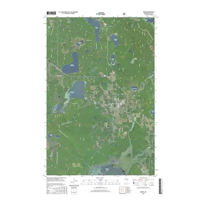
2016 Map of Remer
USGS Topo · Published 2016About this map
Chippewa National Forest provides the setting for this landscape of lakes and waterways in Cass County. The town of Remer sits near the center, serving as a hub for local transit and the small-plane traffic at Remer Municipal Airport. The region's geography is defined by a dense network of water bodies, from the sprawling Big Sand Lake and Little Sand Lake to the southern reaches of Big Rice Lake. The Willow River meanders through the eastern portion of the quadrangle, flanked by numerous marshes and smaller lakes like Mud Lake and Folston Lake. Modern recreation and travel patterns are evident through the extensive trail systems, including the N Country National Scenic Trail and the Soo Line Gia Snowmobile Trail, which trace the paths of former rail corridors and forest routes.
Find a feature on this map
41 named features on this map. Tap any name to fly to it.
Don’t see what you’re looking for? This feature index may not catch every label — zoom into the map to look around manually.
Map Details
Editions of this 2016 Remer Map
This is the sole edition of this map. No revisions or reprints were ever made.
Other maps of this area

1953 · Duluth
USGS Topo · 1:250,000

1953 · Brainerd
USGS Topo · 1:250,000

1954 · Bemidji
USGS Topo · 1:250,000

1954 · Hibbing
USGS Topo · 1:250,000

1957 · Brainerd
USGS Topo · 1:250,000

1957 · Bemidji
USGS Topo · 1:250,000

1957 · Hibbing
USGS Topo · 1:250,000

1958 · Bemidji
USGS Topo · 1:250,000

1958 · Hibbing
USGS Topo · 1:250,000

1958 · Brainerd
USGS Topo · 1:250,000