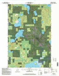
1996 Map of Remer
USGS Topo · Published 1998About this map
Chippewa National Forest encompasses the vast majority of this Northwoods landscape, where the settlement of Remer serves as a central hub near the intersection of local roads. The town's infrastructure is clearly visible, including the Remer Municipal Airport, a local Cemetery, and an Athletic Field. The surrounding terrain is defined by an intricate network of water bodies, notably Big Sand Lake and Little Sand Lake to the west, and the expansive Big Rice Lake at the southern edge.
Find a feature on this map
26 named features on this map. Tap any name to fly to it.
Don’t see what you’re looking for? This feature index may not catch every label — zoom into the map to look around manually.
Map Details
Editions of this 1996 Remer Map
This is the sole edition of this map. No revisions or reprints were ever made.
Other maps of this area

1953 · Duluth
USGS Topo · 1:250,000

1953 · Brainerd
USGS Topo · 1:250,000

1954 · Bemidji
USGS Topo · 1:250,000

1954 · Hibbing
USGS Topo · 1:250,000

1957 · Brainerd
USGS Topo · 1:250,000

1957 · Bemidji
USGS Topo · 1:250,000

1957 · Hibbing
USGS Topo · 1:250,000

1958 · Bemidji
USGS Topo · 1:250,000

1958 · Hibbing
USGS Topo · 1:250,000

1958 · Brainerd
USGS Topo · 1:250,000