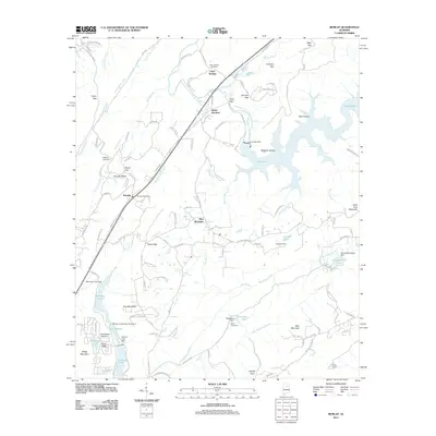
2011 Map of Remlap
USGS Topo · Published 2011About this map
Remlap and its central Remlap Post Office anchor this portrait of north-central Alabama, where the landscape transitions into the steep ridges of Saint Clair Mountain and Bear Mountain. The northeastern portion is dominated by the sprawling waters of Inland Lake, created by the Inland Lake Dam on the Blackburn Fork Little Warrior River. This reservoir, along with Jones Slough and Sawmill Slough, illustrates the mid-century transformation of local waterways into managed utility and recreation sites.
Find a feature on this map
127 named features on this map. Tap any name to fly to it.
Don’t see what you’re looking for? This feature index may not catch every label — zoom into the map to look around manually.
Map Details
Editions of this 2011 Remlap Map
This is the sole edition of this map. No revisions or reprints were ever made.
Other maps of this area

1889 · Springville
USGS Topo · 1:125,000

1889 · Birmingham
USGS Topo · 1:125,000

1892 · Birmingham
USGS Topo · 1:125,000

1892 · Springville
USGS Topo · 1:125,000

1895 · Birmingham
USGS Topo · 1:125,000

1905 · Leeds
USGS Topo · 1:62,500

1907 · Birmingham
USGS Topo · 1:125,000

1907 · Leeds
USGS Topo · 1:62,500

1953 · Birmingham
USGS Topo · 1:250,000

1956 · Birmingham
USGS Topo · 1:250,000