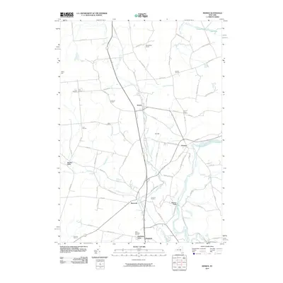
2010 Map of Remsen
USGS Topo · Published 2010About this map
Cincinnati Creek and the West Canada Creek define the corridor of development in this part of Oneida County, where the villages of Remsen and Barneveld serve as historic anchors. The landscape is dotted with several family and community burial grounds, including Capel Lsaf Cemetery and the Penn-Y-Caerau Cemetery, reflecting the region's Welsh heritage and early settlement patterns. Transportation and land use are characterized by the transition from aviation at the RemsenCity Airport to the agricultural operations at Ransoms Tree Farm. The map reveals a dense network of country roads such as Plank Rd and Old State Rte 12, which connect smaller locales like Steuben Valley and Prospect to the primary creek valleys. This topography, shaped by waterways like Steuben Creek and Cady Brook, has long influenced the placement of homes and industry along the valley floors.
Find a feature on this map
83 named features on this map. Tap any name to fly to it.
Don’t see what you’re looking for? This feature index may not catch every label — zoom into the map to look around manually.
Map Details
Editions of this 2010 Remsen Map
This is the sole edition of this map. No revisions or reprints were ever made.
Other maps of this area

1895 · Oriskany
USGS Topo · 1:62,500

1897 · Remsen
USGS Topo · 1:62,500

1898 · Utica
USGS Topo · 1:62,500

1898 · Oriskany
USGS Topo · 1:62,500

1900 · Utica
USGS Topo · 1:62,500

1900 · Remsen
USGS Topo · 1:62,500

1904 · Boonville
USGS Topo · 1:62,500

1943 · Newport
USGS Topo · 1:24,000
1945 · South Trenton
USGS Topo · 1:31,680
1945 · Newport
USGS Topo · 1:31,680