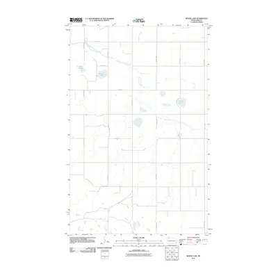
2011 Map of Rennie Lake
USGS Topo · Published 2011About this map
East Branch Short Creek meanders through the central landscape of Burke County, defining the hydrologic character of this prairie region in the early 21st century. The terrain is marked by distinct water bodies including Rennie Lake and the aptly named Shallow Lake, along with the marshy extent of Black Slough to the west. This mapping shows a persistent grid of section-line roads such as 87th Ave NW and 99th St NW, which serve the agricultural operations of the northern plains. The presence of these thoroughfares, including County Rd 11 and various unnamed Twp Rd corridors, highlights the systematic division of the land into manageable tracts for farming and ranching. The lack of concentrated urban development in this quadrant emphasizes the rural, open nature of the country near the Canadian border.
Find a feature on this map
17 named features on this map. Tap any name to fly to it.
Don’t see what you’re looking for? This feature index may not catch every label — zoom into the map to look around manually.
Map Details
Editions of this 2011 Rennie Lake Map
This is the sole edition of this map. No revisions or reprints were ever made.
Other maps of this area

1947 · Flaxton
USGS Topo · 1:24,000

1948 · Flaxton
USGS Topo · 1:24,000

1948 · Beaver Lake
USGS Topo · 1:24,000

1948 · Woburn
USGS Topo · 1:24,000

1948 · Stampede
USGS Topo · 1:24,000

1949 · Rennie Lake
USGS Topo · 1:24,000

1949 · Portal
USGS Topo · 1:24,000

1950 · Flaxton
USGS Topo · 1:62,500

1950 · Portal
USGS Topo · 1:62,500

1953 · Williston
USGS Topo · 1:250,000