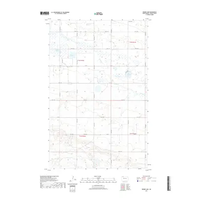
2017 Map of Rennie Lake
USGS Topo · Published 2017About this map
Rennie Lake and its surrounding prairie wetlands define this corner of Burke County, where the glaciated landscape of the Missouri Plateau is evident in numerous small potholes and basins. The terrain is characterized by water bodies like Black Slough and the expansive Shallow Lake, which were historically vital for local drainage and waterfowl habitat. The hydrology of the area is further marked by the winding path of E Br Short Cr, which meanders through the central and eastern sections of the quadrangle. This 2017 survey reflects a largely agricultural and rural landscape, organized by a strict grid of section lines and county roads such as Co Rd 4 and Co Rd 8. The map documents the persistent rural character of North Dakota, where large-scale land management and natural drainage patterns remain the primary features of the physical geography.
Find a feature on this map
19 named features on this map. Tap any name to fly to it.
Don’t see what you’re looking for? This feature index may not catch every label — zoom into the map to look around manually.
Map Details
Editions of this 2017 Rennie Lake Map
This is the sole edition of this map. No revisions or reprints were ever made.
Other maps of this area

1947 · Flaxton
USGS Topo · 1:24,000

1948 · Flaxton
USGS Topo · 1:24,000

1948 · Beaver Lake
USGS Topo · 1:24,000

1948 · Woburn
USGS Topo · 1:24,000

1948 · Stampede
USGS Topo · 1:24,000

1949 · Rennie Lake
USGS Topo · 1:24,000

1949 · Portal
USGS Topo · 1:24,000

1950 · Flaxton
USGS Topo · 1:62,500

1950 · Portal
USGS Topo · 1:62,500

1953 · Williston
USGS Topo · 1:250,000