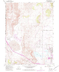
1967 Map of Reno NW
USGS Topo · Published 1983About this map
Reno-Stead Airport serves as a major focal point in this 1960s landscape, situated in the broad expanse of Lemmon Valley. The terrain is defined by the high elevations of Petersen Mountain and the Granite Hills, which separate the development of Reno from the more rural Cold Spring Valley. Transportation and industrial history are visible in the path of the Western Pacific railroad and traces of the Old Railroad Grade north of the airport. Early mining activity is represented by the Antelope Mine and scattered prospects along the mountain flanks. Established settlements like Border Town on the California border and Copperfield near Dry Lake Summit contrast with newer developments such as Silver Knolls Park. The map also captures significant natural features like the ephemeral White Lake and the Silver Lake basin near the city's expanding corporate boundary.
Find a feature on this map
50 named features on this map. Tap any name to fly to it.
Don’t see what you’re looking for? This feature index may not catch every label — zoom into the map to look around manually.
Map Details
Editions of this 1967 Reno NW Map
4 editions found
Other maps of this area

1890 · Sierraville
USGS Topo · 1:125,000

1891 · Reno
USGS Topo · 1:125,000

1892 · Sierraville
USGS Topo · 1:125,000

1893 · Reno
USGS Topo · 1:125,000

1894 · Sierraville
USGS Topo · 1:125,000

1950 · Chilcoot
USGS Topo · 1:62,500

1950 · Reno
USGS Topo · 1:62,500

1951 · Reno
USGS Topo · 1:62,500

1955 · Loyalton
USGS Topo · 1:62,500

1957 · Dogskin Mountain
USGS Topo · 1:62,500