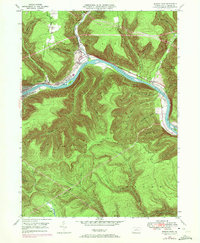
1946 Map of Renovo East
USGS Topo · Published 1972About this map
West Branch Susquehanna River cuts a deep path through the Clinton County highlands, centering a landscape defined by sharp industrial and transit corridors. The communities of Renovo, South Renovo, and North Bend cling to the narrow riverbanks, constrained by the steep slopes of Summerson Mountain and Hyner Mountain. The presence of the Penn Central railroad and the Bucktail Trail underscores the region's historic role as a vital transportation artery through the Pennsylvania wilds. Beyond the river settlements, the terrain is marked by numerous hollows like Skunk Hollow and Benjamin Hollow, where smaller communities like Gleasonton and Hyner are situated. Cultural landmarks such as St Josephs Ch and Fairview Cem provide essential anchor points for genealogists researching the local families of Noyes and Chapman townships.
Find a feature on this map
36 named features on this map. Tap any name to fly to it.
Don’t see what you’re looking for? This feature index may not catch every label — zoom into the map to look around manually.
Map Details
Editions of this 1946 Renovo East Map
4 editions found

Other maps of this area

1921 · Howard
USGS Topo · 1:48,000

1923 · Howard
USGS Topo · 1:62,500

1928 · Snow Shoe
USGS Topo · 1:48,000

1931 · Show Shoe
USGS Topo · 1:62,500

1943 · Hyner
USGS Topo · 1:62,500

1946 · Young Womans Creek
USGS Topo · 1:24,000

1946 · Renovo East
USGS Topo · 1:62,500

1946 · Renovo West
USGS Topo · 1:62,500

1946 · Tamarack
USGS Topo · 1:24,000

1946 · Slate Run
USGS Topo · 1:24,000
Featured Places
- South Renovo, PA
- Gleasonton, Chapman Township
- Noyes Township, PA
- Grugan Township, PA
- North Bend, Chapman Township