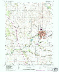
1962 Map of Rensselaer
USGS Topo · Published 1980About this map
St Josephs College and the surrounding agricultural landscape of Jasper County dominate this 1960s survey, updated with 1970s suburban growth. The city of Rensselaer serves as a regional hub, characterized by its dense grid of streets, the Van Rensselaer Sch, and the Iroquois River winding through its southern edge. South of the city, Collegeville and the nearby Mt Calvary Cem mark a distinct cultural and educational enclave.
Find a feature on this map
39 named features on this map. Tap any name to fly to it.
Don’t see what you’re looking for? This feature index may not catch every label — zoom into the map to look around manually.
Map Details
Editions of this 1962 Rensselaer Map
3 editions found
Other maps of this area

1953 · Chicago
USGS Topo · 1:250,000

1953 · Danville
USGS Topo · 1:250,000

1955 · Danville
USGS Topo · 1:250,000

1956 · Danville
USGS Topo · 1:250,000

1957 · Chicago
USGS Topo · 1:250,000

1961 · Mount Ayr
USGS Topo · 1:24,000

1962 · Gifford
USGS Topo · 1:24,000

1962 · Parr
USGS Topo · 1:24,000

1962 · Goodland
USGS Topo · 1:24,000
1962 · Fair Oaks
USGS Topo · 1:24,000