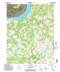
1996 Map of Repton
USGS Topo · Published 1998About this map
Fords Ferry and the Weston landing serve as key points of historical connection along the Ohio River in this Kentucky-Illinois borderland. The river corridor, which includes the Shawnee National Forest to the west, transitions into the dissected ridges of Crittenden County, where agricultural and industrial patterns are etched into the terrain. Evidence of extraction is visible at the Wilson Quarry and a strip mine near the river, while the rural interior is anchored by long-standing community sites like Mount Zion Ch, Browns Sch, and Forest Grove Sch. This 1996 update, based on 1952 topography, documents the area's landscape of named hills and hollows, including the prominent Pinnacle and Cottonpatch Ridge, alongside ancestral sites such as Lamb Cem and Walker Cem.
Find a feature on this map
57 named features on this map. Tap any name to fly to it.
Don’t see what you’re looking for? This feature index may not catch every label — zoom into the map to look around manually.
Map Details
Editions of this 1996 Repton Map
This is the sole edition of this map. No revisions or reprints were ever made.
Other maps of this area

1907 · Morganfield
USGS Topo · 1:62,500

1909 · Providence
USGS Topo · 1:62,500

1916 · Shawneetown
USGS Topo · 1:62,500

1916 · Fords Ferry
USGS Topo · 1:62,500

1921 · Fords Ferry
USGS Topo · 1:48,000

1925 · Cave In Rock
USGS Topo · 1:62,500

1949 · Paducah
USGS Topo · 1:250,000

1950 · Paducah
USGS Topo · 1:250,000

1951 · Sturgis
USGS Topo · 1:24,000
1953 · Dekoven
USGS Topo · 1:24,000