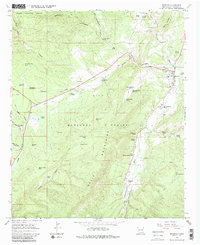
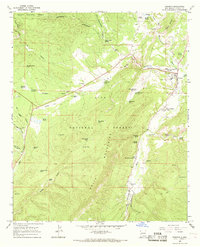
1965 Map of Reserve
USGS Topo · Published 1986About this map
The San Francisco River and Tularosa River converge near the mountain settlement of Reserve, providing a vital water source in this high-altitude landscape. This mid-1960s survey captures the area's agricultural and ranching foundations, with named homesteads like Rothlisberger Ranch, Griffin Ranch, and Hudson Ranch scattered across the valleys. The maps shows the community hub of Reserve in detail, including the local High Sch, a Cem, and the regional Ranger Station.
Find a feature on this map
63 named features on this map. Tap any name to fly to it.
Don’t see what you’re looking for? This feature index may not catch every label — zoom into the map to look around manually.
Map Details
Editions of this 1965 Reserve Map
2 editions found
Other maps of this area

1915 · Reserve
USGS Topo · 1:125,000

1918 · Reserve
USGS Topo · 1:125,000

1954 · Clifton
USGS Topo · 1:250,000

1957 · Clifton
USGS Topo · 1:250,000

1958 · Clifton
USGS Topo · 1:250,000

1962 · Clifton
USGS Topo · 1:250,000
1963 · Sign Camp Mountain
USGS Topo · 1:24,000
1963 · Saliz Pass
USGS Topo · 1:24,000
1963 · O Block Canyon
USGS Topo · 1:24,000
1965 · Reserve
USGS Topo · 1:24,000
Featured Places
- Reserve, NM
- Lower San Francisco Plaza, NM
- Rancho Grande Estates, NM
- San Francisco Plaza, NM
- Catron County, NM