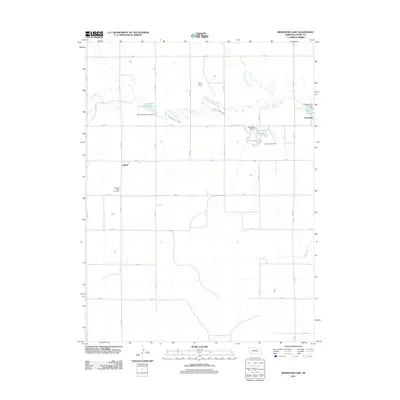
2011 Map of Reservoir Lake
USGS Topo · Published 2011About this map
Frenchman Creek and its managed waterways define the agricultural and recreational landscape of western Nebraska in this early 21st-century study. The small settlement of Champion is a focal point near the eastern edge, supported by the Champion Canal and the local Mill Pond. The map reveals a complex water management system including the Kilpatrick Diversion Reservoir and Kilpatrick Reservoir 1, illustrating how irrigation infrastructure dictates the local geography. Local history is anchored by sites like Lake View Cemetery and Pleasant View Cemetery, while the presence of Smith Field and the Champion Lake Camping Area indicates the region's balance between aviation utility and leisure. The township-and-range grid is clearly delineated by numbered roads, such as 322 Ave and 732 Rd, which connect these rural outposts and water control structures.
Find a feature on this map
30 named features on this map. Tap any name to fly to it.
Don’t see what you’re looking for? This feature index may not catch every label — zoom into the map to look around manually.
Map Details
Editions of this 2011 Reservoir Lake Map
This is the sole edition of this map. No revisions or reprints were ever made.
Other maps of this area

1954 · McCook
USGS Topo · 1:250,000

1957 · McCook
USGS Topo · 1:250,000

1958 · McCook
USGS Topo · 1:250,000

1961 · Lamar
USGS Topo · 1:24,000

1973 · Champion
USGS Topo · 1:24,000
1973 · Lamar
USGS Topo · 1:24,000
1973 · Chase
USGS Topo · 1:24,000

1973 · Champion SW
USGS Topo · 1:24,000

1973 · Imperial
USGS Topo · 1:24,000

1973 · Reservoir Lake SE
USGS Topo · 1:24,000