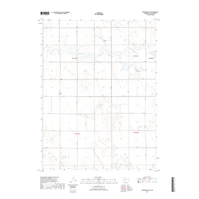
2017 Map of Reservoir Lake
USGS Topo · Published 2017About this map
Frenchman Cr meanders across this Chase County landscape, driving a system of water management that includes the Kilpatrick Diversion Reservoir and the Champion Canal. The settlement of Champion is positioned at the eastern edge near the Mill Pond, while the smaller community of Crete sits to the west along the section lines of 733 RD. The terrain is defined by a series of drainages such as Davidson Br and Foerster Br which feed into the primary river valley.
Find a feature on this map
28 named features on this map. Tap any name to fly to it.
Don’t see what you’re looking for? This feature index may not catch every label — zoom into the map to look around manually.
Map Details
Editions of this 2017 Reservoir Lake Map
This is the sole edition of this map. No revisions or reprints were ever made.
Other maps of this area

1954 · McCook
USGS Topo · 1:250,000

1957 · McCook
USGS Topo · 1:250,000

1958 · McCook
USGS Topo · 1:250,000

1961 · Lamar
USGS Topo · 1:24,000

1973 · Champion
USGS Topo · 1:24,000
1973 · Lamar
USGS Topo · 1:24,000
1973 · Chase
USGS Topo · 1:24,000

1973 · Champion SW
USGS Topo · 1:24,000

1973 · Imperial
USGS Topo · 1:24,000

1973 · Reservoir Lake SE
USGS Topo · 1:24,000