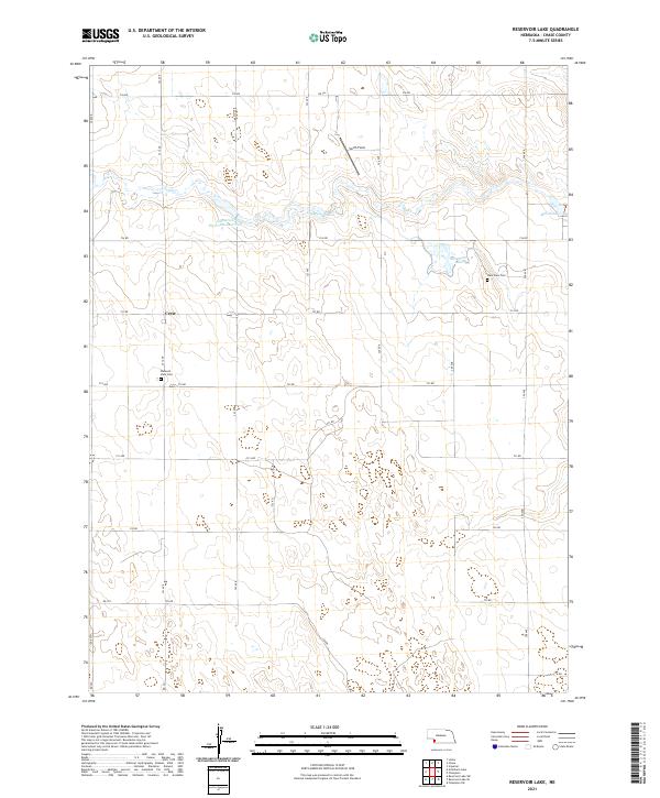
2021 Map of Reservoir Lake
USGS Topo · Published 2021About this map
The agricultural plains of Chase County are defined here by a sophisticated irrigation network centered on the Champion Canal and the Kilpatrick Diversion Reservoir. This water management system, branching through the Frenchman Creek valley, supported the sparse settlements and farmsteads established during the region's development. Small markers of community life appear in the rural landscape, such as the village of Crete and the local airstrip at Smith Field. For genealogists and local historians, the map identifies specific burial grounds like Lake View Cem and Pleasant View Cem, which remain as permanent anchors for families who settled this portion of southwest Nebraska. The geometric precision of the section lines and rural routes, such as 732 RD and 323 Ave, highlights the orderly transformation of the High Plains into a productive ranching and farming district.
Find a feature on this map
28 named features on this map. Tap any name to fly to it.
Don’t see what you’re looking for? This feature index may not catch every label — zoom into the map to look around manually.
Map Details
Editions of this 2021 Reservoir Lake Map
This is the sole edition of this map. No revisions or reprints were ever made.
Other maps of this area

1954 · McCook
USGS Topo · 1:250,000

1957 · McCook
USGS Topo · 1:250,000

1958 · McCook
USGS Topo · 1:250,000

1961 · Lamar
USGS Topo · 1:24,000

1973 · Champion
USGS Topo · 1:24,000
1973 · Lamar
USGS Topo · 1:24,000
1973 · Chase
USGS Topo · 1:24,000

1973 · Champion SW
USGS Topo · 1:24,000

1973 · Imperial
USGS Topo · 1:24,000

1973 · Reservoir Lake SE
USGS Topo · 1:24,000