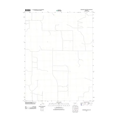
2011 Map of Reservoir Lake SW
USGS Topo · Published 2011About this map
This corner of Chase County represents the organized geometry of rural Nebraska's section-line road network in the early 21st century. The map depicts a landscape dominated by the intersection of thoroughfares like 314 Ave and 727 Rd, tracing the paths that connect isolated ranching and farming operations. These roads, including 315 Ave and 726 Rd, follow the rigid township and range surveying system, illustrating how late-modern infrastructure continues to adhere to 19th-century land divisions. The presence of 318 Ave further highlights the systematic grid of the Great Plains, where long, straight routes serve as the primary conduits for movement across the expansive agricultural territory.
Find a feature on this map
5 named features on this map. Tap any name to fly to it.
Don’t see what you’re looking for? This feature index may not catch every label — zoom into the map to look around manually.
Map Details
Editions of this 2011 Reservoir Lake SW Map
This is the sole edition of this map. No revisions or reprints were ever made.
Other maps of this area

1954 · Sterling
USGS Topo · 1:250,000

1954 · McCook
USGS Topo · 1:250,000

1957 · McCook
USGS Topo · 1:250,000

1958 · McCook
USGS Topo · 1:250,000

1958 · Sterling
USGS Topo · 1:250,000

1971 · Alvin
USGS Topo · 1:24,000

1971 · Wray NE
USGS Topo · 1:24,000

1971 · Alvin NE
USGS Topo · 1:24,000
1973 · Haigler NE
USGS Topo · 1:24,000

1973 · Reservoir Lake SE
USGS Topo · 1:24,000