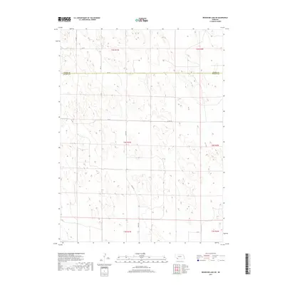
2017 Map of Reservoir Lake SW
USGS Topo · Published 2017About this map
The high plains of southwest Nebraska are defined by the straight-line jurisdictional boundary of Chase Co Dundy Co, a division that marks the transition between Chase and Dundy Counties. This 2017 survey shows a landscape largely organized by the Public Land Survey System, where section lines dictate the placement of rural infrastructure such as Rd 726 and Rd 727. The area is sparsely populated, characterized by the undulating sand hills and seasonal wetlands common to this corner of the state.
Find a feature on this map
13 named features on this map. Tap any name to fly to it.
Don’t see what you’re looking for? This feature index may not catch every label — zoom into the map to look around manually.
Map Details
Editions of this 2017 Reservoir Lake SW Map
This is the sole edition of this map. No revisions or reprints were ever made.
Other maps of this area

1954 · Sterling
USGS Topo · 1:250,000

1954 · McCook
USGS Topo · 1:250,000

1957 · McCook
USGS Topo · 1:250,000

1958 · McCook
USGS Topo · 1:250,000

1958 · Sterling
USGS Topo · 1:250,000

1971 · Alvin
USGS Topo · 1:24,000

1971 · Wray NE
USGS Topo · 1:24,000

1971 · Alvin NE
USGS Topo · 1:24,000
1973 · Haigler NE
USGS Topo · 1:24,000

1973 · Reservoir Lake SE
USGS Topo · 1:24,000