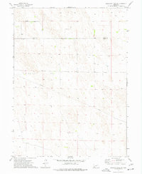
1973 Map of Reservoir Lake SW
USGS Topo · Published 1977About this map
The high plains of southwestern Nebraska, specifically along the northern boundary of Dundy County, are defined by a rhythmic landscape of undulating dunes and dry drainage patterns. This 1973 survey illustrates the sparse, rural infrastructure of the region, where the Chase Co and Dundy Co line cuts through a territory dominated by sand hills and cattle grazing. Human activity is evidenced by a network of scattered wells essential for livestock and land management, alongside a major Pipeline that traverses the terrain from northwest to southeast. The map's topographic detail captures the subtle elevation changes of the Nebraska panhandle before the advent of modern center-pivot irrigation systems began to transform the local agricultural footprint.
Find a feature on this map
3 named features on this map. Tap any name to fly to it.
Don’t see what you’re looking for? This feature index may not catch every label — zoom into the map to look around manually.
Map Details
Editions of this 1973 Reservoir Lake SW Map
This is the sole edition of this map. No revisions or reprints were ever made.
Other maps of this area

1954 · Sterling
USGS Topo · 1:250,000

1954 · McCook
USGS Topo · 1:250,000

1957 · McCook
USGS Topo · 1:250,000

1958 · McCook
USGS Topo · 1:250,000

1958 · Sterling
USGS Topo · 1:250,000

1971 · Alvin
USGS Topo · 1:24,000

1971 · Wray NE
USGS Topo · 1:24,000

1971 · Alvin NE
USGS Topo · 1:24,000
1973 · Haigler NE
USGS Topo · 1:24,000

1973 · Reservoir Lake SE
USGS Topo · 1:24,000