
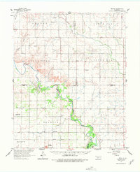
1961 Map of Retrop
USGS Topo · Published 1963About this map
The North Fork Red River carves a winding path across this 1961 landscape, defining the intersection of Beckham, Washita, Greer, and Kiowa counties. The era is marked by a dual economy of agriculture and energy, seen in the wide distribution of oil wells and prominent sites like the West Sentinel Oil Field alongside established rural communities. Cultural life in these townships is rooted in landmarks such as Highway Ch, Zion Ch, and Port Sch, which served the surrounding farming districts.
Find a feature on this map
38 named features on this map. Tap any name to fly to it.
Don’t see what you’re looking for? This feature index may not catch every label — zoom into the map to look around manually.
Map Details
Editions of this 1961 Retrop Map
2 editions found
Other maps of this area

1955 · Lawton
USGS Topo · 1:250,000

1955 · Clinton
USGS Topo · 1:250,000

1957 · Clinton
USGS Topo · 1:250,000

1957 · Dill City
USGS Topo · 1:62,500

1960 · Sayre
USGS Topo · 1:62,500

1961 · Hobart
USGS Topo · 1:62,500

1961 · Willow
USGS Topo · 1:62,500

1961 · Elk City
USGS Topo · 1:62,500

1964 · Lone Wolf
USGS Topo · 1:24,000

1971 · Mangum North
USGS Topo · 1:24,000