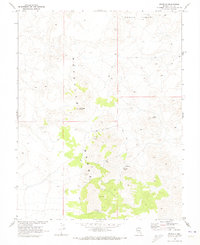
1968 Map of Reveille
USGS Topo · Published 1973About this map
Reveille Range dominates this late 1960s survey, illustrating a landscape defined by isolated mining operations and the high desert terrain of Nye County. The map provides a detailed look at the silver and lead mining history of the district, showing the precise locations of the Lost Burro Mine, Gila Mine, Kietzke Mine, and the New Reveille Mine. These sites are linked by a network of jeep trails that navigate the high-elevation ridges near Streuben Knob and the oddly named Goblin Knobs to the north.
Find a feature on this map
16 named features on this map. Tap any name to fly to it.
Don’t see what you’re looking for? This feature index may not catch every label — zoom into the map to look around manually.
Map Details
Editions of this 1968 Reveille Map
2 editions found
Other maps of this area

1908 · Kawich
USGS Topo · 1:250,000

1942 · Reveille Peak
USGS Topo · 1:125,000

1952 · Kawich Peak
USGS Topo · 1:62,500

1952 · Reveille Peak
USGS Topo · 1:62,500

1954 · Goldfield
USGS Topo · 1:250,000

1955 · Goldfield
USGS Topo · 1:250,000

1956 · Tonopah
USGS Topo · 1:250,000

1958 · Goldfield
USGS Topo · 1:250,000

1959 · Tonopah
USGS Topo · 1:250,000

1962 · Goldfield
USGS Topo · 1:250,000