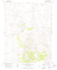
1968 Map of Reveille
USGS Topo · Published 1981About this map
Mining operations and high-desert terrain define this mid-century survey of the Reveille Range. The landscape is dominated by the industrial legacy of the district, specifically the New Reveille Mine and the Lost Burro Mine. Near the center of the sheet, the Reveille (Site) and various Ruins indicate the location of former settlements and structures that once supported the local extraction economy. The topography is distinctive, featuring the high points of Streuben Knob and the strangely named Goblin Knobs to the north. Water sources are scarce in this arid environment, with only Hyde Spring and a generic Spring near the old townsite providing reliable points of interest for historical geography. Access through the region is primarily limited to a network of Jeep Trails that wind through the steep, mountainous elevations.
Find a feature on this map
16 named features on this map. Tap any name to fly to it.
Don’t see what you’re looking for? This feature index may not catch every label — zoom into the map to look around manually.
Map Details
Editions of this 1968 Reveille Map
2 editions found
Other maps of this area

1908 · Kawich
USGS Topo · 1:250,000

1942 · Reveille Peak
USGS Topo · 1:125,000

1952 · Kawich Peak
USGS Topo · 1:62,500

1952 · Reveille Peak
USGS Topo · 1:62,500

1954 · Goldfield
USGS Topo · 1:250,000

1955 · Goldfield
USGS Topo · 1:250,000

1956 · Tonopah
USGS Topo · 1:250,000

1958 · Goldfield
USGS Topo · 1:250,000

1959 · Tonopah
USGS Topo · 1:250,000

1962 · Goldfield
USGS Topo · 1:250,000