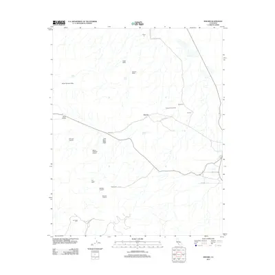
2012 Map of Reward
USGS Topo · Published 2012About this map
Reward sits at the heart of this industrial and pastoral landscape in Kern County, where the infrastructure of the California oil industry meets historic ranching lands. The map documents an area heavily influenced by petroleum extraction, with sites for Standard Oil, Tidewater Associated Oil, Union Oil, and Welport Oil punctuating the terrain. This industrial footprint is balanced by a network of family-held lands, including the A M Cooper Ranch and the Old Cooper Ranch.
Find a feature on this map
26 named features on this map. Tap any name to fly to it.
Don’t see what you’re looking for? This feature index may not catch every label — zoom into the map to look around manually.
Map Details
Editions of this 2012 Reward Map
This is the sole edition of this map. No revisions or reprints were ever made.
Other maps of this area

1912 · McKittrick
USGS Topo · 1:125,000

1931 · Lokern
USGS Topo · 1:31,680

1932 · West Elk Hills
USGS Topo · 1:31,680

1934 · Lokern
USGS Topo · 1:31,680

1941 · Caliente Mountain
USGS Topo · 1:62,500

1942 · Caliente Mtn
USGS Topo · 1:62,500

1943 · Simmler
USGS Topo · 1:62,500
1943 · Belridge
USGS Topo · 1:31,680

1943 · Caliente Mtn.
USGS Topo · 1:62,500

1944 · Panorama Hills
USGS Topo · 1:31,680