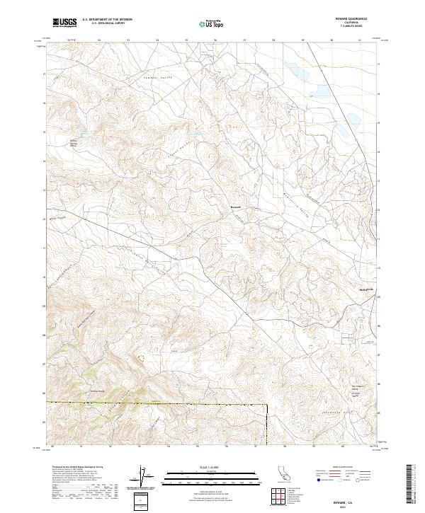
2021 Map of Reward
USGS Topo · Published 2021About this map
The oil-rich landscapes of Western Kern County are defined by the convergence of the Temblor Range and the San Joaquin Valley. This survey captures the isolated settlements of Reward and McKittrick, located at the mouth of the McKittrick Valley. The terrain is deeply incised by drainages such as Pottinger Canyon, Maddux Canyon, and Little Santa Maria Valley, which flow from the higher elevations of the range toward the valley floor. Rare water sources like Willow Springs and Sulphur Spring punctuate this arid environment. The map also delineates the Kern Co San Luis Obispo Co line across the southwestern corner, marking the rugged transition toward the coast. Local roads like Reward Rd and Franco Western Rd provide the primary access through these hills and canyons.
Find a feature on this map
32 named features on this map. Tap any name to fly to it.
Don’t see what you’re looking for? This feature index may not catch every label — zoom into the map to look around manually.
Map Details
Editions of this 2021 Reward Map
This is the sole edition of this map. No revisions or reprints were ever made.
Other maps of this area

1912 · McKittrick
USGS Topo · 1:125,000

1931 · Lokern
USGS Topo · 1:31,680

1932 · West Elk Hills
USGS Topo · 1:31,680

1934 · Lokern
USGS Topo · 1:31,680

1941 · Caliente Mountain
USGS Topo · 1:62,500

1942 · Caliente Mtn
USGS Topo · 1:62,500

1943 · Simmler
USGS Topo · 1:62,500
1943 · Belridge
USGS Topo · 1:31,680

1943 · Caliente Mtn.
USGS Topo · 1:62,500

1944 · Panorama Hills
USGS Topo · 1:31,680