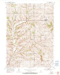
1952 Map of Rewey
USGS Topo · Published 1990About this map
Mining and agriculture intersect across the rolling uplands of southwest Wisconsin in this early 1950s survey. The landscape is defined by the headwaters of the Little Platte River and its tributaries like Williams Branch, where numerous Inactive Mines, Mine Dumps, and quarries underscore the region's lead and zinc heritage. The village of Rewey serves as a local hub along the Chicago and North Western railroad, which cuts through the northeastern corner of the map.
Find a feature on this map
30 named features on this map. Tap any name to fly to it.
Don’t see what you’re looking for? This feature index may not catch every label — zoom into the map to look around manually.
Map Details
Editions of this 1952 Rewey Map
3 editions found
Other maps of this area

1900 · Lancaster
USGS Topo · 1:125,000

1902 · Mineral Point
USGS Topo · 1:125,000

1904 · Lancaster
USGS Topo · 1:125,000

1908 · Lancaster
USGS Topo · 1:125,000

1952 · Platteville
USGS Topo · 1:24,000

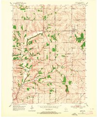
1952 · Rewey
USGS Topo · 1:24,000

1952 · Montfort
USGS Topo · 1:24,000

1952 · Belmont
USGS Topo · 1:24,000

1952 · Linden
USGS Topo · 1:24,000

1952 · Mifflin
USGS Topo · 1:24,000