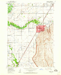
1949 Map of Rexburg
USGS Topo · Published 1960About this map
Rexburg serves as the focal point of this 1940s landscape, established as a regional center of education and agriculture in eastern Idaho. The presence of Ricks College, the Courthouse, and the Rigby Hosp underscores the town's role as a developed hub during this era. Surrounding the urban grid, a complex network of irrigation infrastructure including the Ward Canal, Hibbard Canal, and Rexburg Canal illustrates the transformation of the Snake River Plain through water management. The hydrology is dominated by the braiding channels of Henrys Fork and the South Fork Teton River, which create the expansive Teton Island. Smaller outlying settlements like Sugar City, Thornton, and Salem are connected by the Union Pacific Yellowstone Branch, while community life is anchored by landmarks such as the Independence Ward Ch and the Burton Cem.
Find a feature on this map
41 named features on this map. Tap any name to fly to it.
Don’t see what you’re looking for? This feature index may not catch every label — zoom into the map to look around manually.
Map Details
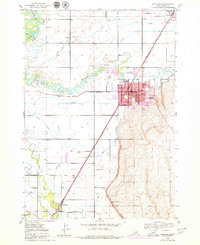
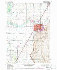
Editions of this 1949 Rexburg Map
4 editions found
Other maps of this area

1948 · Rigby
USGS Topo · 1:24,000

1948 · Parker
USGS Topo · 1:24,000

1949 · Rexburg
USGS Topo · 1:24,000

1949 · Rigby
USGS Topo · 1:24,000

1950 · Ririe
USGS Topo · 1:24,000

1950 · Parker
USGS Topo · 1:24,000

1950 · Rexburg
USGS Topo · 1:24,000

1950 · St Anthony
USGS Topo · 1:24,000

1950 · Rigby
USGS Topo · 1:62,500

1951 · Moody
USGS Topo · 1:24,000