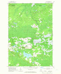
1964 Map of Rexton
USGS Topo · Published 1966About this map
Industrial and natural history converge in this survey of Hiawatha National Forest and the surrounding Mackinac State Forest. The local economy is marked by the massive Fiborn Quarry, connected to the landscape by several former transport corridors including the Dinky Line and multiple stretches of Old Railroad Grade. These routes suggest an era of intensive resource extraction and timber harvesting that preceded the mid-1960s field check.
Find a feature on this map
45 named features on this map. Tap any name to fly to it.
Don’t see what you’re looking for? This feature index may not catch every label — zoom into the map to look around manually.
Map Details
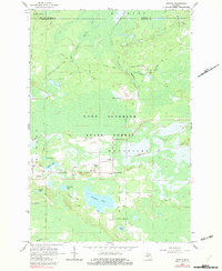
Editions of this 1964 Rexton Map
2 editions found
Other maps of this area

1931 · Epoufette SE
USGS Topo · 1:31,680

1931 · Epoufette NE
USGS Topo · 1:31,680

1931 · Epoufette NW
USGS Topo · 1:31,680

1931 · Epoufette SW
USGS Topo · 1:31,680

1931 · Gilchrist NE
USGS Topo · 1:31,680

1951 · Hulbert
USGS Topo · 1:24,000

1951 · Eckerman
USGS Topo · 1:24,000

1951 · Eckerman
USGS Topo · 1:62,500

1954 · Sault Sainte Marie
USGS Topo · 1:250,000

1956 · Sault Sainte Marie
USGS Topo · 1:250,000