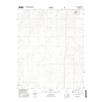
2016 Map of Reydon SW
USGS Topo · Published 2016About this map
Rankin serves as the primary settlement hub in this 2016 survey of western Oklahoma, situated just west of the sprawling Black Kettle National Grassland. The landscape is defined by a grid of rural roads and the management of local water resources through several engineered catchments, including the Upper Washita Site 46 Reservoir, Upper Washita Site 47 Reservoir, and Deputy Reservoir. These sites, along with drainage from Rush Cr and Croton Cr, reflect the vital agricultural and conservation infrastructure of Roger Mills County. For local historians and genealogists, the inclusion of White Rose Cem near the northern boundary provides a specific point of reference for family research. The map illustrates a contemporary rural environment where public lands and private agricultural interests intersect within the unique mixed-grass prairie ecosystem of the southern Great Plains.
Find a feature on this map
28 named features on this map. Tap any name to fly to it.
Don’t see what you’re looking for? This feature index may not catch every label — zoom into the map to look around manually.
Map Details
Editions of this 2016 Reydon SW Map
This is the sole edition of this map. No revisions or reprints were ever made.
Other maps of this area

1954 · Amarillo
USGS Topo · 1:250,000

1955 · Clinton
USGS Topo · 1:250,000

1957 · Clinton
USGS Topo · 1:250,000

1958 · Amarillo
USGS Topo · 1:250,000

1960 · Sweetwater
USGS Topo · 1:62,500

1961 · Reydon
USGS Topo · 1:62,500

1963 · Allison
USGS Topo · 1:24,000

1963 · Kelton
USGS Topo · 1:24,000

1967 · Hackberry Creek
USGS Topo · 1:24,000
1982 · Pampa
USGS Topo · 1:100,000