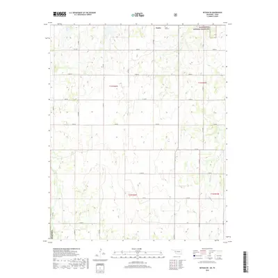
2018 Map of Reydon SW
USGS Topo · Published 2018About this map
Rankin serves as a central reference point in this corner of Roger Mills County, where the landscape is defined by the expansive Black Kettle National Grassland. The terrain is characterized by a series of draws and ridges, drained in the southeastern quadrant by Croton Cr. This area reflects the rural character of western Oklahoma, with a strictly organized grid of section-line roads like N 1740 Rd and E 1000 Rd that provide access to the various pastures and townships. Genealogists and local historians will find the White Rose Cem north of the main settlement, a quiet landmark situated amidst the grassland and rolling contours that dominate the region north of the t12n r26w township boundary.
Find a feature on this map
29 named features on this map. Tap any name to fly to it.
Don’t see what you’re looking for? This feature index may not catch every label — zoom into the map to look around manually.
Map Details
Editions of this 2018 Reydon SW Map
This is the sole edition of this map. No revisions or reprints were ever made.
Other maps of this area

1954 · Amarillo
USGS Topo · 1:250,000

1955 · Clinton
USGS Topo · 1:250,000

1957 · Clinton
USGS Topo · 1:250,000

1958 · Amarillo
USGS Topo · 1:250,000

1960 · Sweetwater
USGS Topo · 1:62,500

1961 · Reydon
USGS Topo · 1:62,500

1963 · Allison
USGS Topo · 1:24,000

1963 · Kelton
USGS Topo · 1:24,000

1967 · Hackberry Creek
USGS Topo · 1:24,000
1982 · Pampa
USGS Topo · 1:100,000