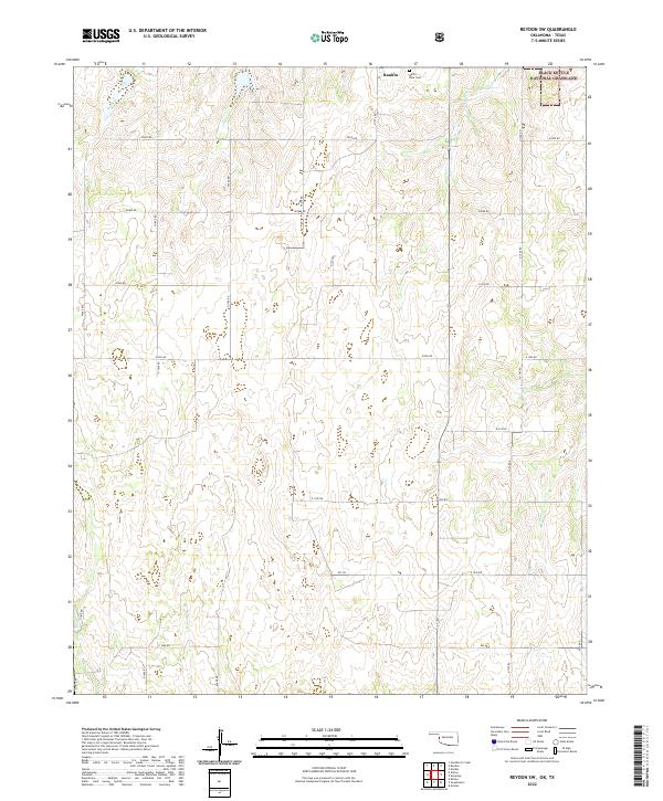
2022 Map of Reydon SW
USGS Topo · Published 2022About this map
Black Kettle National Grassland dominates the northeastern corner of this West Oklahoma landscape, preserving a portion of the high plains ecosystem. The settlement of Rankin serves as a small focal point in the northern section, situated near the White Rose Cemetery. The terrain is defined by the headwaters and drainage patterns of Rush Creek and Croton Creek, which carve subtle relief into the prairie. A rigid grid of section-line roads, including E0970 Rd and N 1730 Rd, organizes the agricultural and ranching land. This modern survey reflects the enduring homestead-era layout of Roger Mills County, where the sparse population is reflected in the vast stretches of open land between isolated landmarks and homesteads.
Find a feature on this map
29 named features on this map. Tap any name to fly to it.
Don’t see what you’re looking for? This feature index may not catch every label — zoom into the map to look around manually.
Map Details
Editions of this 2022 Reydon SW Map
This is the sole edition of this map. No revisions or reprints were ever made.
Other maps of this area

1954 · Amarillo
USGS Topo · 1:250,000

1955 · Clinton
USGS Topo · 1:250,000

1957 · Clinton
USGS Topo · 1:250,000

1958 · Amarillo
USGS Topo · 1:250,000

1960 · Sweetwater
USGS Topo · 1:62,500

1961 · Reydon
USGS Topo · 1:62,500

1963 · Allison
USGS Topo · 1:24,000

1963 · Kelton
USGS Topo · 1:24,000

1967 · Hackberry Creek
USGS Topo · 1:24,000
1982 · Pampa
USGS Topo · 1:100,000